FOSS4G Presentation about pgRouting
In 2013 pgRouting was presentated at three FOSS4G events, in Nottingham , Tokyo and Osaka . In case you have missed them all, take a look at the presentation slides:
2013 was a very successful year for the pgRouting project, but we hope 2014 will become even better!

pgRouting announces pgRouting 2.0.0 release
This 2.0 release brings a number of major new features:
- All Pairs Shortest Path, Johnson’s Algorithm NEW
- All Pairs Shortest Path, Floyd-Warshall Algorithm NEW
- Shortest Path A*
- Bi-directional Dijkstra Shortest Path NEW
- Bi-directional A* Shortest Path NEW
- Shortest Path Dijkstra
- Driving Distance
- K-Shortest Path, Multiple Alternative Paths NEW
- K-Dijkstra, One to Many Shortest Path NEW
- Traveling Sales Person NEW Implementation
- Turn Restriction Shortest Path (TRSP) NEW
- New functions for creating routing topology
- New functions for analyzing a graph for problems
pgRouting 2.0 is not backwards compatible with the 1.x version. This is a significant overhaul of the whole pgRouting environment and we have renamed all the functions and rationalized the arguments and return types. While this will be a painful migration for 1.x applications, we believe the new functionality, the high quality of the code, and new documentation will make it much easier to grow the product and support it over future releases.

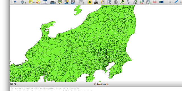
Joining Tables with SQL using pyQGIS
One of the features that makes MapInfo’s MapBasic very useful is the ability to join a normal tabular data with a spatial data using plain SQL statements within an application. This is useful because it makes it possible to link numerous attribute tables (census, crime, marketing, etc. data) with just 1 table that contains the spatial information (map data).

Geoserver Security using the Seasar Web Framework
Although Geoserver has its own valid Security system, exposing it directly to the internet still raises concerns, especially if Geoserver is being used to host corporate data. One source of these concerns is that Geoserver offers numerous Services that have to be closed properly, and a single unintended mistake in closing these Services might lead to an unauthorised access to the Services or sensitive data. This is in the same vein as a Database (Oracle or PostgreSQL ) which has its own security system, but it will be foolhardy to make it accessible to the Internet instead of in the backend of an application where it rightfully belongs.

pgRouting 2.0 is coming soon
With the (inofficial) alpha, beta and rc1 release of the new pgRouting 2.0.0 lots of smaller and bigger issues have been fixed: for example TSP now accepts a start and also an end point, the “develop” branch is checked on Travis CI with every commit and tested with different versions of PostgreSQL/PostGIS, the documentation can be translated with Transifex , etc..

Georepublic at FOSS4G in Notthingham
In September the annual FOSS4G will take place in Nottingham, and beside being a sponsor Georepublic will attend the event with three of us travelling from Tokyo and Osaka. We are also planning to attend State of the Map in Birmingham, UK and the Quantum GIS Developer Meeting in Brighton before heading to FOSS4G.

The Cuisines of the world
Tags or tagging are quite underrated in mapping where colourful lines/dots make up for most of the look and feel. OpenStreetMap as the name says is an open map but also is a open geographic database licensed under ODBL . The beauty of the data is that its not just a dump of all the data but follows a certain schema and could also be said to be semantic in nature aka it could be easily queried by a human or machine to get required information.

Leaflet example with WFS-T
This article is supposed to be No. 15 in the Japanese FOSS4G Advent Calendar 2012 and it’s probably the first and last one in English for this year. First I wanted to build pgRouting Ubuntu packages and write about it, but then I saw the other great blog posts and decided to change the topic.

How to contribute to an existing Octopress blog
You managed to setup your own Octopress blog? Great! After a while you switch to another PC or your colleague wants to contribute an article and nothing worked as easy as I expected.

The Georepublic Times is using Octopress
Let’s start with a first post about how to publish articles on Georepublic’s brand-new blog.
Since the writing of blog articles has almost stalled in this year, even if Georepublic’s population nearly doubled since 2011, there was probably something wrong the old blog system. Because we’re all not very ambitious novelists, there had to be something that we were more familiar with.

PostGIS and pgRouting template
When creating a new database in PostgreSQL using the standard template, PostGIS and pgRouting functions and tables are missing of course. You can add these functions and tables one by one, but doing this every time for every single database is annoying work.

pgRouting Project News
It has been a long way but finally we made it: I’m glad to be able to announce the new pgRouting website, that also comes with a lot of other changes and news! I hope the migration doesn’t produce a lot of confusion but makes it easier to participate in the project and make development faster and better!